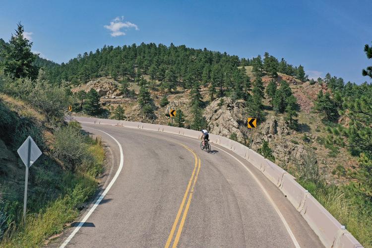
![Climbing Magnolia Drive, Boulder, Colorado Climbing Magnolia Drive, Boulder, Colorado - stretch of two-lane road surrounded by evergreen trees and mountains]()
Cycling Magnolia Drive
A beast of a climb out of Boulder, Colorado
Ride 4.5 miles gaining 2,185’ at 9.1% average grade.
Climb summary by PJAMM’s John Johnson.
![Climbing Magnolia Drive, Boulder, Colorado Climbing Magnolia Drive, Boulder, Colorado - photo collage, PJAMM Cycling logo in corner, bike parked next to sign for Roosevelt National Forest, multiple aerial drone views of curves in roadway]()
![Climbing Magnolia Drive, Boulder, Colorado Climbing Magnolia Drive, Boulder, Colorado - stretch of two-lane roadway curving up mountainside, road signs warning of Steep Mountain Road and windy road, 10 MPH road sign]()
The thing about Magnolia Road is that it hits you with a right cross on the chin as soon as you enter the ring -- after a few pedal strokes you’re at 11.8% average grade for a quarter-mile and 11% for the first mile (gaining a whopping 620' over that distance). The steepest stretch is 0.2 miles at mile 2.88-3.08 (16.4%).
![Climbing Magnolia Drive, Boulder, Colorado Climbing Magnolia Drive, Boulder, Colorado - photo collage, PJAMM Cycling logo in corner, bike parked along guardrail overlooking creek, PJAMM Cycling white SAG van parked along roadside]()
There is plenty of parking at the beginning of the climb.
![Climbing Magnolia Drive, Boulder, Colorado Climbing Magnolia Drive, Boulder, Colorado - PJAMM cycling logo in corner, multiple aerial drone views of hairpin curve in roadway]()
Hairpin #1.
![Climbing Magnolia Drive, Boulder, Colorado Climbing Magnolia Drive, Boulder, Colorado - climb map and gradient]()
The first 9/10s of a mile are at 12.3% (it felt like more). . .
. . . be prepared!
This is a beautiful and scenic ride as can be seen from our YouTube playlist of the climb. We enter Roosevelt National Forest at 0.8 miles as we struggle with mid-teen grades just before the grade eases for a short bit at about the 0.9 mile mark. With the seventh highest average grade of the Top 100 climbs at 10%, this little devil will surely test your legs.
![Climbing Magnolia Drive, Boulder, Colorado Climbing Magnolia Drive, Boulder, Colorado - PJAMM Cycling logo in corner, bike parked against wooden sign on roadside for Roosevelt National Forest]()
![Climbing Magnolia Drive, Boulder, Colorado Climbing Magnolia Drive, Boulder, Colorado - photo collage, PJAMM Cycling logo in corner, bike handlebars looking out over mountainside, climb gradient and map, bike parked along roadside near evergreen trees, Garmin reading 16%, bike parked along roadside next to sign for 14% grade, stretch of two-lane roadway]()
The climb and its grade can be followed on our YouTube video which uses Garmin Virb with grade and elevation overlays.
Traffic and Roadway Report: As of August 2014, the roadway surface was very good. While there is no shoulder on this road, there is not a lot of traffic either -- the road felt safe to ride.
![Climbing Magnolia Drive, Boulder, Colorado Climbing Magnolia Drive, Boulder, Colorado - photo collage, PJAMM Cycling logo in corner, bike laying down in center of two-lane roadway with PJAMM Cycling jersey draped over it, bike parked next to road sign for steep roadway, bike parked against pine tree on roadside]()
The blessed finish -- that is one TOUGH road bike climb. 👍👍

 We've partnered with Sherpa-Map.com to bring you the best route planning tool. With a PRO Membership you can use this climb as a reference when creating your route.

